%20--%3e%3cdefs%3e%3cstyle%3e%20.st0%20{%20fill:%20%23061b40;%20}%20.st1%20{%20fill:%20%23306af1;%20}%20.st2%20{%20fill:%20%235ce5cf;%20}%20%3c/style%3e%3c/defs%3e%3cg%3e%3cpath%20class='st0'%20d='M55,10.5h9v3h-9v9h12V7.5h-12v3ZM64,19.5h-6v-3h6v3Z'/%3e%3cpolygon%20class='st0'%20points='69%2016.5%2078%2016.5%2078%2019.5%2069%2019.5%2069%2022.5%2081%2022.5%2081%2013.5%2072%2013.5%2072%2010.5%2081%2010.5%2081%207.5%2069%207.5%2069%2016.5'/%3e%3cpolygon%20class='st0'%20points='95%2010.5%2095%207.5%2083%207.5%2083%2022.5%2095%2022.5%2095%2019.5%2086%2019.5%2086%2016.5%2095%2016.5%2095%2013.5%2086%2013.5%2086%2010.5%2095%2010.5'/%3e%3cpath%20class='st0'%20d='M40,1.5v21h11.6l1.4-1.4v-7.6h0c0,0-1.4-1.5-1.4-1.5l1.4-1.4V2.9l-1.4-1.4h-11.6ZM50,19.5h-7v-6h7v6ZM50,10.5h-7v-6h7v6Z'/%3e%3c/g%3e%3cpath%20class='st1'%20d='M23.1,24L14.7,4.8l-4.9,11.2h3.8l-1.8,4H3.3L12.1,0H2C.9,0,0,.9,0,2v20c0,1.1.9,2,2,2h21.1Z'/%3e%3cpath%20class='st2'%20d='M34,0h-16.8l10.6,24h6.2c1.1,0,2-.9,2-2V2C36,.9,35.1,0,34,0ZM32.5,20h-4V4h4v16Z'/%3e%3c/svg%3e)

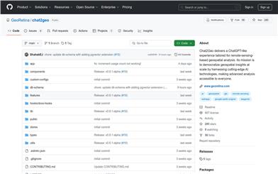
Chat2geo
Overview :
Chat2Geo is a web application built on Next.js 15 that provides a ChatGPT-like chat interface for performing remote sensing-based geospatial analysis. It leverages Google Earth Engine to process and analyze various remote sensing datasets in the backend. Users can upload their own vector data, run advanced geospatial queries, and integrate with an AI assistant to complete tasks such as land cover mapping, change detection, and air pollutant monitoring. By combining geospatial analysis with non-geospatial/textual information, this product offers a powerful and practical Knowledge Retrieval Augmented Generation (RAG) workflow. It inherits most of the building blocks of the GRAI 2.0 application developed by GeoRetina and is continuously updated to meet community needs.
Target Users :
Chat2Geo is ideal for geospatial analysts, researchers, environmental scientists, and professionals who need to process remote sensing data. It offers a user-friendly interface that enables advanced geospatial analysis without requiring complex programming knowledge. Additionally, its knowledge retrieval capabilities empower users to combine geospatial data with other textual information, providing more comprehensive support for decision-making.
Use Cases
Researchers use Chat2Geo to analyze land cover changes in specific regions to study the impact of urban expansion on the natural environment.
Environmental scientists use the tool to monitor air pollutant distribution, providing data support for environmental policy making.
Urban planners use Chat2Geo's urban heat island analysis function to assess the impact of urban planning on the urban thermal environment.
Features
Provides a chat-like interactive interface, allowing users to interact with the system using natural language.
Integrates Google Earth Engine to process and analyze satellite imagery and remote sensing data in real-time.
Supports users in uploading and managing personal vector data, integrating it with Earth Engine operations.
Offers a variety of geospatial analysis tools, such as land cover mapping, change detection, and urban heat island analysis.
Supports Knowledge Retrieval Augmented Generation (RAG), allowing users to upload documents to build a local knowledge base and combine it with geospatial analysis results.
How to Use
1. Clone the Chat2Geo repository to your local machine.
%20--%3e%3cdefs%3e%3cstyle%3e%20.st0%20{%20fill:%20%230080ff;%20}%20%3c/style%3e%3c/defs%3e%3cpath%20class='st0'%20d='M16.2,11.1c.4.5.4,1.2,0,1.8l-4.7,7.1h-3.8l5.3-8L7.6,4h3.8l4.7,7.1Z'/%3e%3c/svg%3e)
2. Install project dependencies: Run `npm install`.
3. Create a Google Earth Engine account and project, and configure the environment variables.
4. Set up a Supabase database and authentication service, and obtain the necessary API keys.
5. Configure the `.env.local` file, filling in the API keys for GCP, Supabase, and other services.
6. Start the development server: Run `npm run dev`.
7. Access `http://localhost:3000` to begin using Chat2Geo for geospatial analysis.


Featured AI Tools

Globe Explorer
Globe Explorer is a new AI-powered search engine that offers a personalized search experience, supports multilingual searches, and is committed to delivering high-quality search results. It can automatically organize search keywords into mind maps, aiding users in quickly and clearly comprehending information.
AI search
2.9M
Chinese Picks
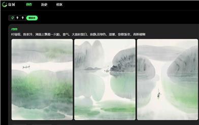
Chiyu
Chiyu is a creative discovery website that provides a wealth of creative resources and tools to help users realize their creative dreams. Chiyu offers various creative forms, including text, images, and videos. Users can easily create and edit through Chiyu. Chiyu provides various creative tools and material libraries, enabling users to quickly produce exquisite works. Chiyu also provides a platform for user communication and exhibition, where users can share their works, communicate and interact with other creators. Chiyu's pricing is flexible, and users can choose the appropriate package according to their needs. Whether professional creators or creative enthusiasts, they can find their own creative joy in Chiyu.
Other categories
2.2M