%20--%3e%3cdefs%3e%3cstyle%3e%20.st0%20{%20fill:%20%23061b40;%20}%20.st1%20{%20fill:%20%23306af1;%20}%20.st2%20{%20fill:%20%235ce5cf;%20}%20%3c/style%3e%3c/defs%3e%3cg%3e%3cpath%20class='st0'%20d='M55,10.5h9v3h-9v9h12V7.5h-12v3ZM64,19.5h-6v-3h6v3Z'/%3e%3cpolygon%20class='st0'%20points='69%2016.5%2078%2016.5%2078%2019.5%2069%2019.5%2069%2022.5%2081%2022.5%2081%2013.5%2072%2013.5%2072%2010.5%2081%2010.5%2081%207.5%2069%207.5%2069%2016.5'/%3e%3cpolygon%20class='st0'%20points='95%2010.5%2095%207.5%2083%207.5%2083%2022.5%2095%2022.5%2095%2019.5%2086%2019.5%2086%2016.5%2095%2016.5%2095%2013.5%2086%2013.5%2086%2010.5%2095%2010.5'/%3e%3cpath%20class='st0'%20d='M40,1.5v21h11.6l1.4-1.4v-7.6h0c0,0-1.4-1.5-1.4-1.5l1.4-1.4V2.9l-1.4-1.4h-11.6ZM50,19.5h-7v-6h7v6ZM50,10.5h-7v-6h7v6Z'/%3e%3c/g%3e%3cpath%20class='st1'%20d='M23.1,24L14.7,4.8l-4.9,11.2h3.8l-1.8,4H3.3L12.1,0H2C.9,0,0,.9,0,2v20c0,1.1.9,2,2,2h21.1Z'/%3e%3cpath%20class='st2'%20d='M34,0h-16.8l10.6,24h6.2c1.1,0,2-.9,2-2V2C36,.9,35.1,0,34,0ZM32.5,20h-4V4h4v16Z'/%3e%3c/svg%3e)

Georetina
Overview :
GeoRetina is a platform focused on geospatial intelligence, utilizing AI technology to transform complex geospatial data into immediate insights. The product facilitates rapid analysis of land cover changes, environmental dynamics, and more, through automated processing and real-time monitoring. Key advantages include efficient data processing capabilities, real-time environmental monitoring, and robust predictive capabilities. GeoRetina is suitable for commercial and research applications requiring fast and accurate geospatial analysis. Pricing and specific positioning are tailored to customer needs.
Target Users :
GeoRetina is ideal for businesses, research institutions, and government organizations that need to quickly gain insights from geospatial data. It helps them monitor environmental changes in real-time, predict future trends, and improve decision-making efficiency and scientific rigor through AI-powered automation of complex data processing.
Use Cases
Enhanced Carbon Footprint Analysis: Precisely calculate and analyze carbon emissions using geospatial data.
Habitat and Biodiversity Monitoring: Track ecological changes in real-time to protect biodiversity.
Urban Heat Island Analysis: Analyze the urban heat island effect to provide a scientific basis for urban planning.
Features
10x faster geospatial data processing, reducing manual analysis time from days/weeks to hours/minutes.
Real-time environmental monitoring, tracking environmental changes 24/7 with no delays or blind spots.
AI-driven automated decision intelligence, simplifying complex processes and allowing users to focus on decision-making.
Supports 3D visualization analysis, providing users with a new perspective.
Offers hyperlocal analysis, customizing analysis results based on user's local data.
Features advanced predictive capabilities, helping users analyze future trends.
Open-source geospatial AI, infinitely scalable.
How to Use
1. Visit the GeoRetina website and register for an account.
%20--%3e%3cdefs%3e%3cstyle%3e%20.st0%20{%20fill:%20%230080ff;%20}%20%3c/style%3e%3c/defs%3e%3cpath%20class='st0'%20d='M16.2,11.1c.4.5.4,1.2,0,1.8l-4.7,7.1h-3.8l5.3-8L7.6,4h3.8l4.7,7.1Z'/%3e%3c/svg%3e)
2. Log in and select the type of geospatial data you want to analyze.
3. Enter relevant parameters or upload your data to initiate AI analysis.
4. View real-time monitoring results or download analysis reports.
5. Utilize the 3D visualization feature for further data exploration.


Featured AI Tools
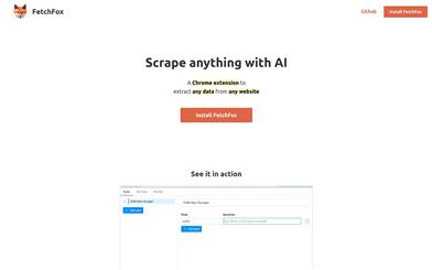
Fetchfox
FetchFox is an AI-driven web scraping tool. It leverages AI to extract the data you need from raw web pages. Running as a Chrome extension, users can simply describe the desired data in English. With FetchFox, you can quickly collect data such as building lead lists, gathering research data, or surveying market segments. By using AI to scrape from raw text, FetchFox can bypass anti-scraping measures on websites like LinkedIn and Facebook. It can easily parse even the most complex HTML structures.
Data Analysis
412.1K
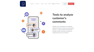
Comments Analytics
Comments Analyzer is a tool that helps users extract and analyze page comments. It utilizes artificial intelligence technology to extract and quantify emotional information from comments, providing functionalities such as sentiment analysis, entity recognition, and keyword extraction. By analyzing comments, users can understand customer thoughts, feelings, and decision-making processes, ultimately leading to improved customer experience and product or service optimization.
Data Analysis
315.5K