%20--%3e%3cdefs%3e%3cstyle%3e%20.st0%20{%20fill:%20%23061b40;%20}%20.st1%20{%20fill:%20%23306af1;%20}%20.st2%20{%20fill:%20%235ce5cf;%20}%20%3c/style%3e%3c/defs%3e%3cg%3e%3cpath%20class='st0'%20d='M55,10.5h9v3h-9v9h12V7.5h-12v3ZM64,19.5h-6v-3h6v3Z'/%3e%3cpolygon%20class='st0'%20points='69%2016.5%2078%2016.5%2078%2019.5%2069%2019.5%2069%2022.5%2081%2022.5%2081%2013.5%2072%2013.5%2072%2010.5%2081%2010.5%2081%207.5%2069%207.5%2069%2016.5'/%3e%3cpolygon%20class='st0'%20points='95%2010.5%2095%207.5%2083%207.5%2083%2022.5%2095%2022.5%2095%2019.5%2086%2019.5%2086%2016.5%2095%2016.5%2095%2013.5%2086%2013.5%2086%2010.5%2095%2010.5'/%3e%3cpath%20class='st0'%20d='M40,1.5v21h11.6l1.4-1.4v-7.6h0c0,0-1.4-1.5-1.4-1.5l1.4-1.4V2.9l-1.4-1.4h-11.6ZM50,19.5h-7v-6h7v6ZM50,10.5h-7v-6h7v6Z'/%3e%3c/g%3e%3cpath%20class='st1'%20d='M23.1,24L14.7,4.8l-4.9,11.2h3.8l-1.8,4H3.3L12.1,0H2C.9,0,0,.9,0,2v20c0,1.1.9,2,2,2h21.1Z'/%3e%3cpath%20class='st2'%20d='M34,0h-16.8l10.6,24h6.2c1.1,0,2-.9,2-2V2C36,.9,35.1,0,34,0ZM32.5,20h-4V4h4v16Z'/%3e%3c/svg%3e)


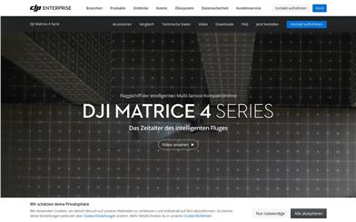
DJI Matrice 4 Series
Overview :
The DJI Matrice 4 Series is a high-performance drone designed for industrial applications, introduced by DJI. The series includes two models: Matrice 4T and Matrice 4E, equipped with powerful smart inspection and laser marking measurement capabilities. The Matrice 4T is suitable for various scenarios including power line inspections, emergency response, public safety, and water resource monitoring, while the Matrice 4E focuses on high-precision professional surveying and detailed surface inspections. Its open body design with enhanced AI computing power and upgraded accessories improves the safety and reliability of the flight system, thereby enhancing operational efficiency and precision. This high-end industrial drone is priced starting at ¥38,888 for the Matrice 4T and ¥27,888 for the Matrice 4E, making it suitable for enterprises and organizations in need of high-precision and high-efficiency aerial operations.
Target Users :
Designed for enterprises and institutions that require high-precision surveying, inspection, and emergency rescue operations in complex environments, such as power companies, emergency management departments, and surveying firms.
Use Cases
Power Line Inspection: Utilizing the laser measurement and telephoto camera of the Matrice 4T for detailed inspection of power transmission lines, promptly identifying potential faults.
Emergency Rescue: After a natural disaster, utilize the Matrice 4 Series drones for aerial search and quickly locate trapped individuals.
Geographic Information Surveying: Use the high-precision surveying features of the Matrice 4E to efficiently survey large areas and produce high-precision 3D models.
Features
Built-in innovative AI models for detecting people, vehicles, and vessels, with the capability to switch to third-party detection models.
Laser measurement module for precise marking and measurement, supporting real-time data sharing.
Multiple intelligent flight modes available, such as constant speed, waypoint navigation, tracking, and orbiting.
Equipped with a range of high-performance cameras including wide-angle, medium-zoom, telephoto, and thermal imaging cameras.
Features robust night vision mode and near-infrared illumination capabilities for operation in low-light environments.
Supports high-precision surveying with 0.5-second timed photography and multidirectional shooting.
Integrated positioning and navigation systems ensure safe return in complex environments.
Equipped with O4 Enterprise transmission system, with a transmission range of up to 25 kilometers, providing stable video transmission.
How to Use
1. Preparation: Check the drone battery level, install necessary cameras and accessories, and ensure the aircraft is in optimal condition.
%20--%3e%3cdefs%3e%3cstyle%3e%20.st0%20{%20fill:%20%230080ff;%20}%20%3c/style%3e%3c/defs%3e%3cpath%20class='st0'%20d='M16.2,11.1c.4.5.4,1.2,0,1.8l-4.7,7.1h-3.8l5.3-8L7.6,4h3.8l4.7,7.1Z'/%3e%3c/svg%3e)
2. Pre-flight Setup: Use the DJI Pilot 2 app to configure flight parameters, including altitude, speed, and flight path planning.
3. Takeoff and Flight: Launch the drone in a safe environment and conduct operations based on the predefined flight path or manual control, monitoring flight status and data in real-time.
4. Data Collection: Use the drone's onboard cameras and sensors for data collection, such as capturing photos, videos, or performing laser measurements.
5. Data Processing: After the flight, import collected data into software like DJI Terra for processing, generating required maps, 3D models, or other analytical results.
6. Result Analysis and Application: Analyze the processed data to draw conclusions or propose solutions and implement them in practical operations.


Featured AI Tools
Chinese Picks
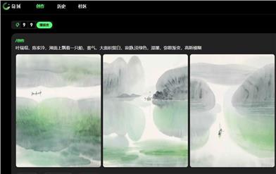
Chiyu
Chiyu is a creative discovery website that provides a wealth of creative resources and tools to help users realize their creative dreams. Chiyu offers various creative forms, including text, images, and videos. Users can easily create and edit through Chiyu. Chiyu provides various creative tools and material libraries, enabling users to quickly produce exquisite works. Chiyu also provides a platform for user communication and exhibition, where users can share their works, communicate and interact with other creators. Chiyu's pricing is flexible, and users can choose the appropriate package according to their needs. Whether professional creators or creative enthusiasts, they can find their own creative joy in Chiyu.
Other categories
2.2M
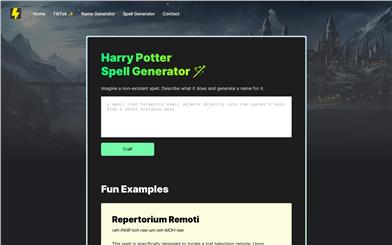
Harry Potter Spell Generator
The Harry Potter Spell Generator is a tool that can generate spell names in a Harry Potter style. Users can describe an imaginary spell and get a fitting name for it. Through this tool, users can experience the fun of creating magic.
Other categories
179.7K